
Text and photography by Dean Sewell
As a photographer I’ve been concentrating the Murray Darling Basin for the the good part of the last two decades.
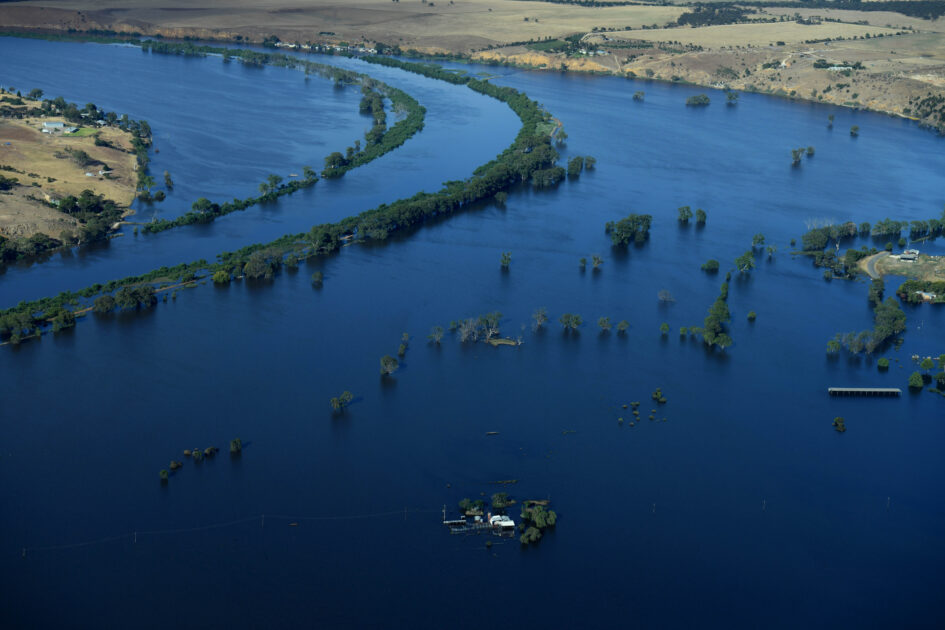
I wanted to go back to South Australia, to the lower part of the Murray River from Mannum to Murray Bridge, Lake Alexandria, the Coorong, the mouth itself. I’ve only ever photographed those areas in drought. This is the first time I witnessed that part of the The Basin in flood.
It was a self-initiated assignment. I don’t have time for people to ponder whether we should be covering stories like that or not. I wanted to reach the peak of the flood when it hit Mannum, a riverside town on the lower reaches of the Murray once famous for its steam boats.
These flood waters had their origin in the upper catchments of the Darling River from more than a year before. It was what you call a dry flood, no rain fell. All this water had originated through hundreds of kilometres of one of the most complex river systems in the world.
I knew that the flood peak was going to occur around the 11th of January 2023.
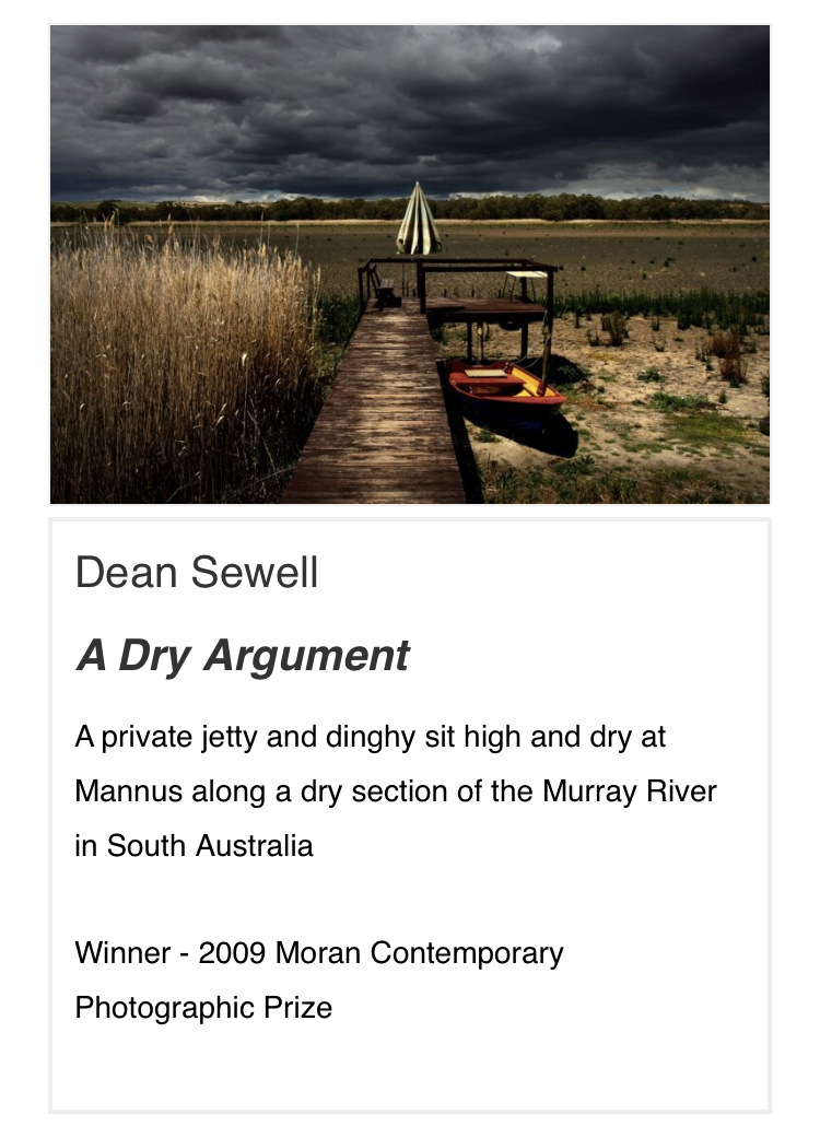
My last visit to Mannum was in 2009. That was at the peak of the Millennium Drought, as it was known.
I wanted to go back to visit the site from which I captured an image that won me the 2009 Moran Contemporary Photographic prize. I knew there was a lot of water down there and wasn’t completely sure if I’d be able to get to the same location.
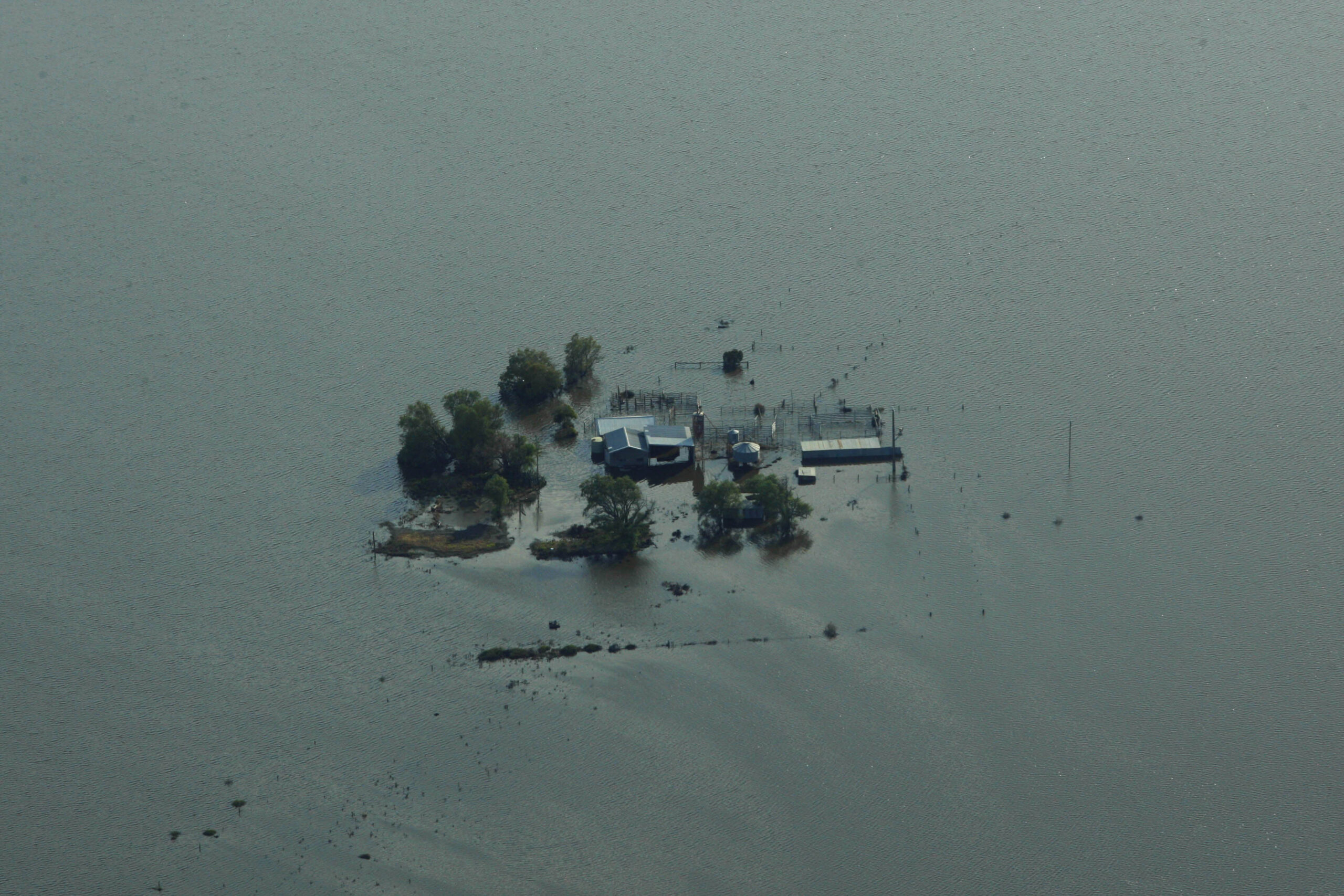
As it turned out, there was so much water that I could barely even recognise the town much less where I had captured that image back in 2009.
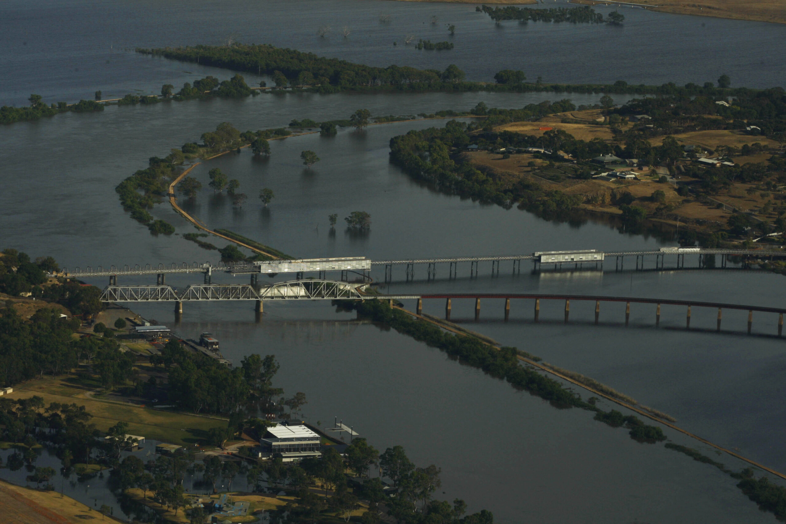
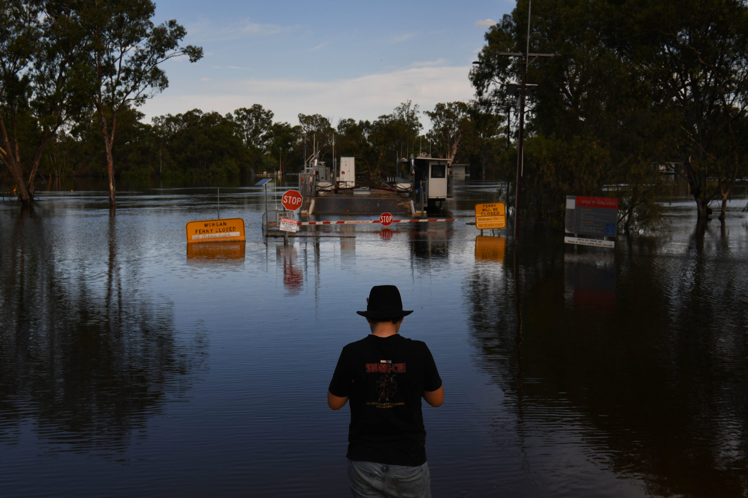
Mannum was severed by the flood waters, the only crossing point of the lower part of the river being at Murray Bridge, the next town down the river.
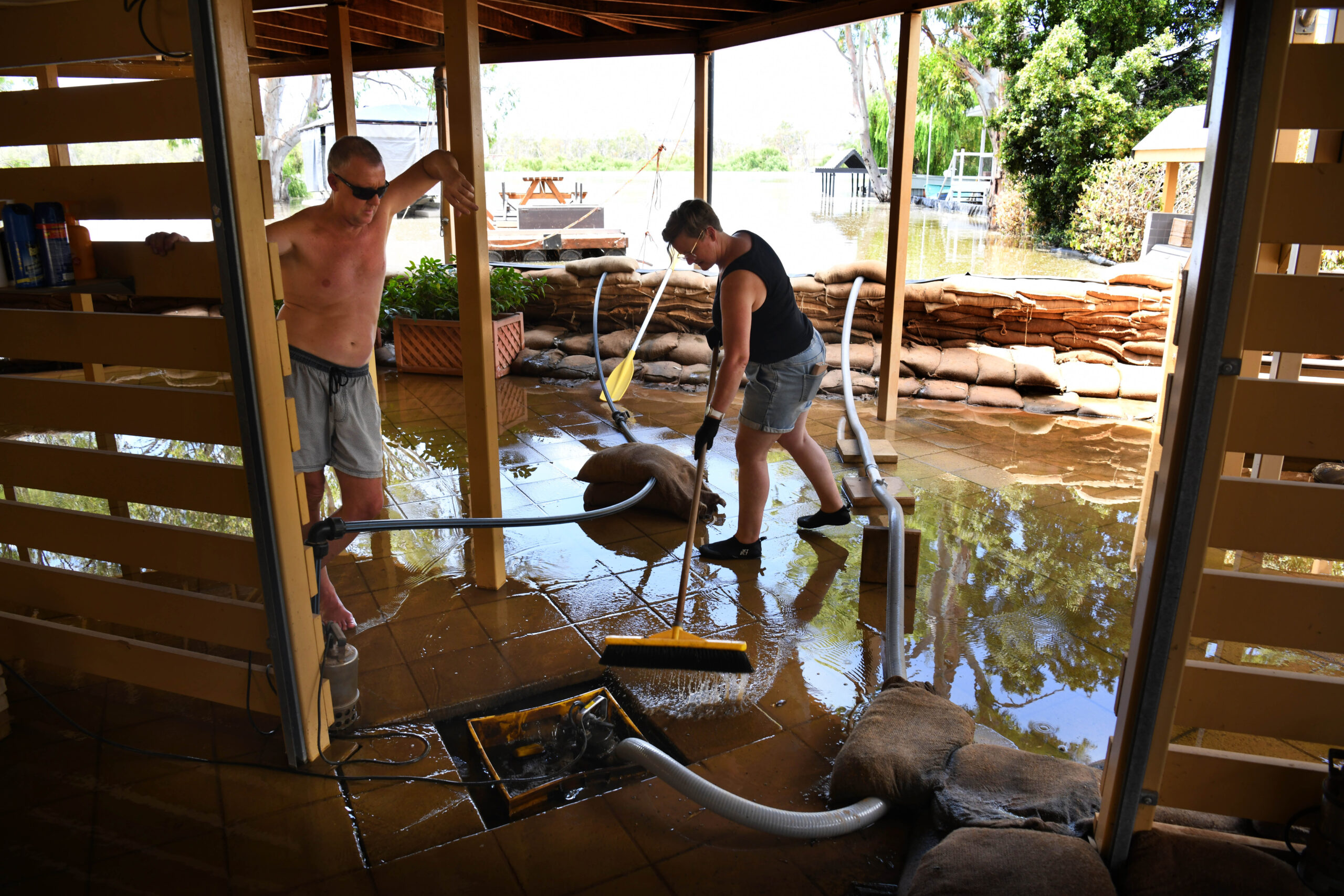
While many households were isolated, thankfully the township was largely saved by newly elected levies.
The levees built in 1974 all failed and the the land on the Eastern side of the Murray, which is largely cattle grazing country, went underwater.

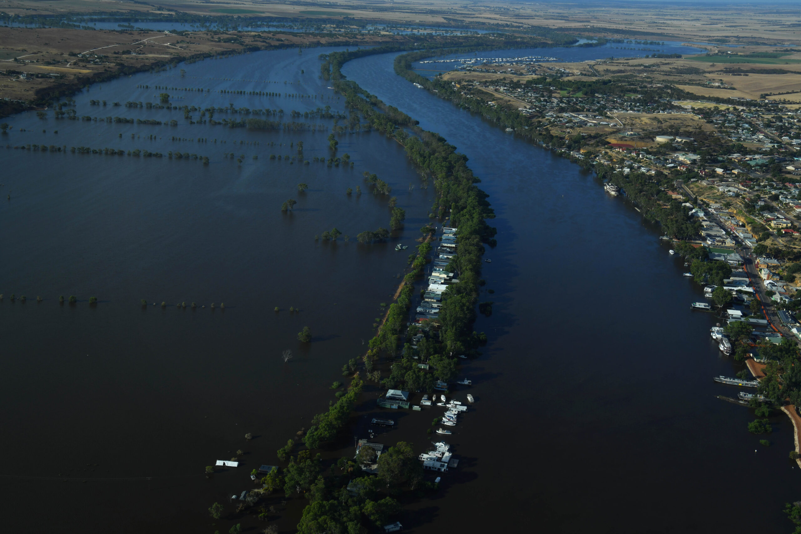
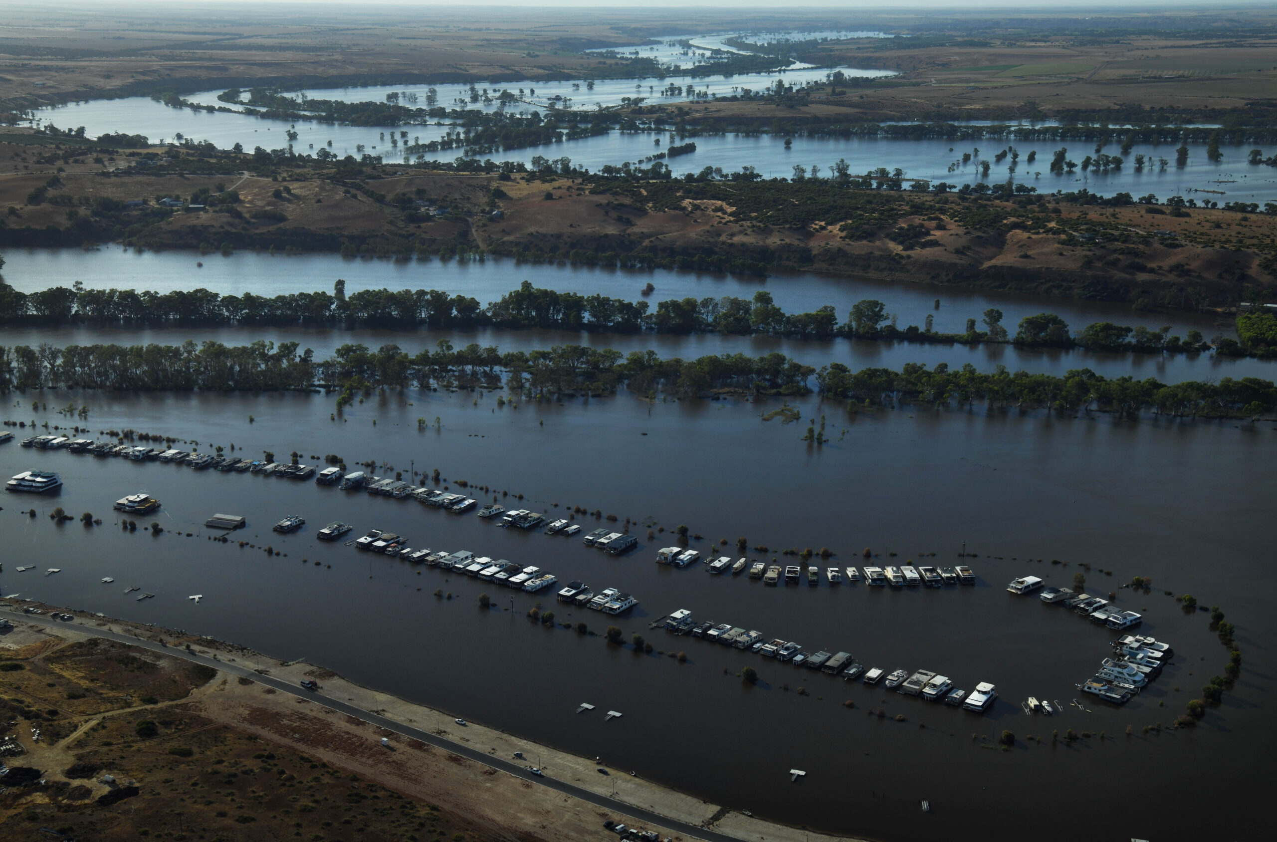
Mannum, like all of the lower Murray townships was deserted. The South Australian government banned all recreational activity, and this was in the height of a South Australian summer and school holidays.
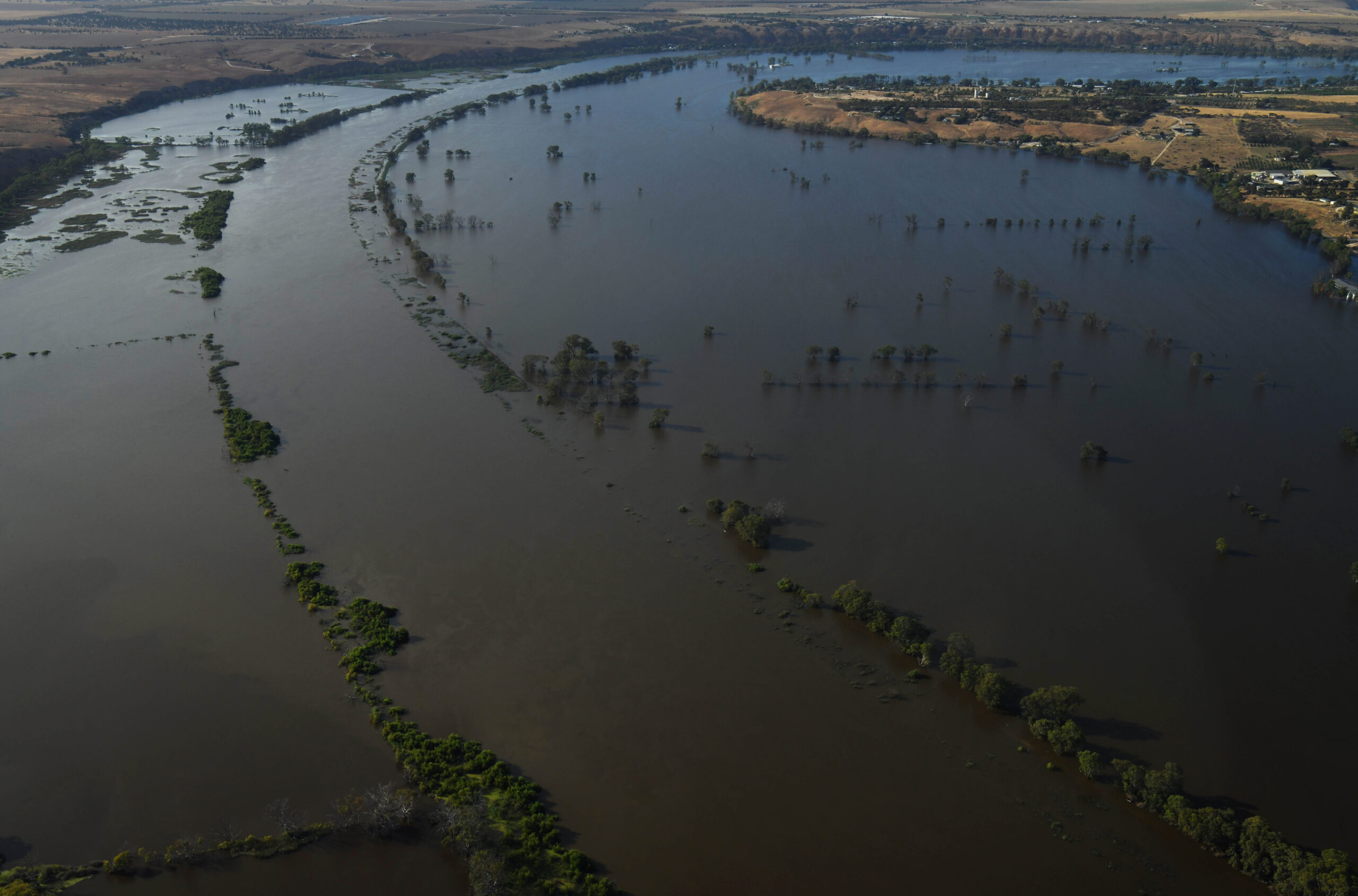
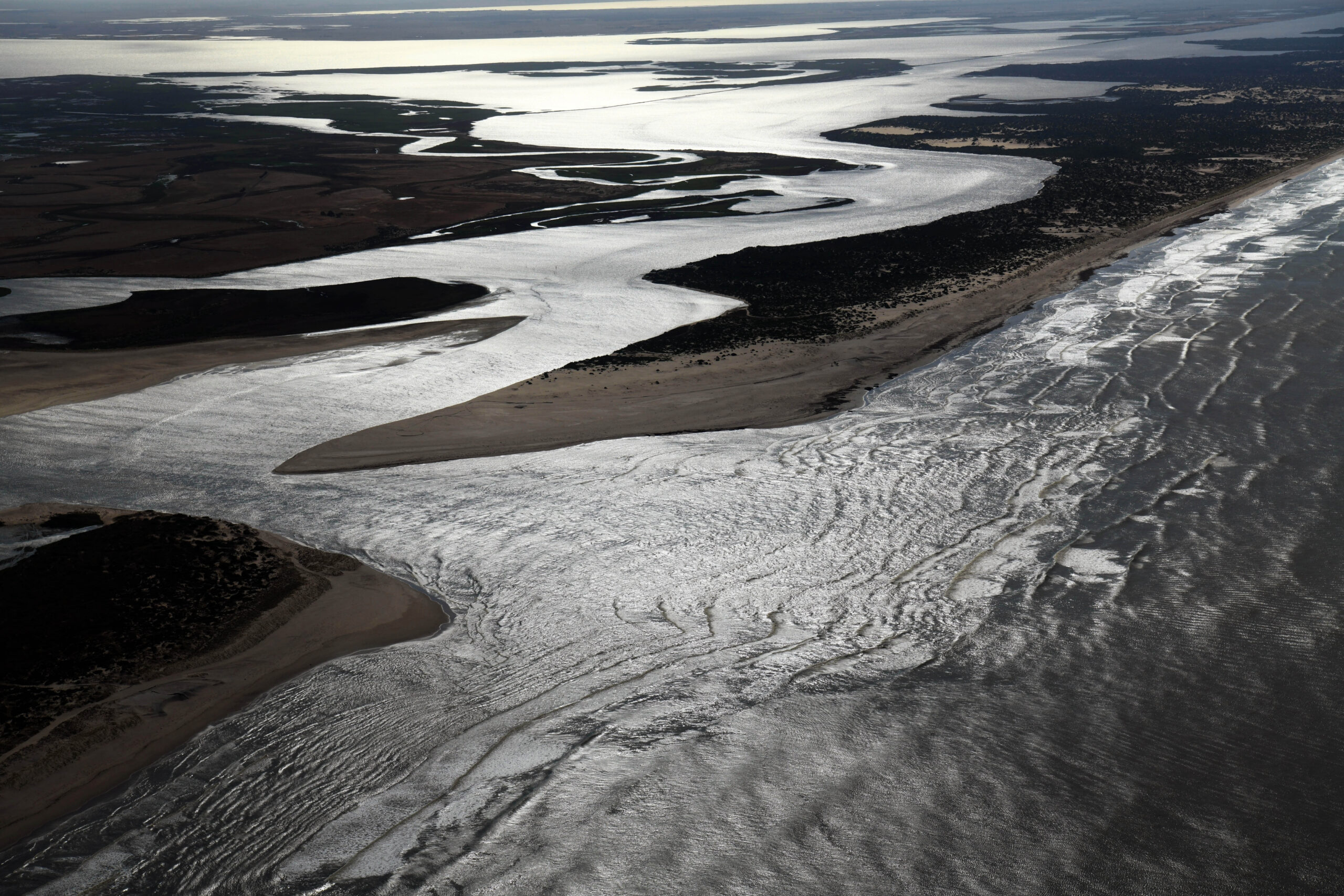
The lower Murray was like a ghost river, there was not a soul to be seen. But if you put aside the industry losses and their costs, what you were seeing was the Murray in it’s full grandeur, the natural state of how it should look and behave in a flood event of such scale; the water spreading out across its flood Plains.
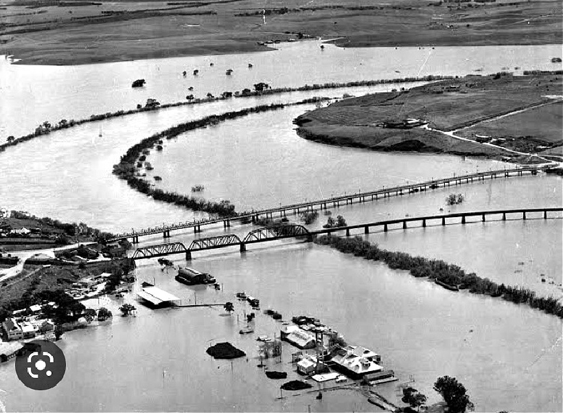
The last time such scenes were possible were during the flood event of 1956 when photographers captured similar scenes. Back then, they were using medium format cameras and black and white film. This is the first time that such scenes were capture in colour.
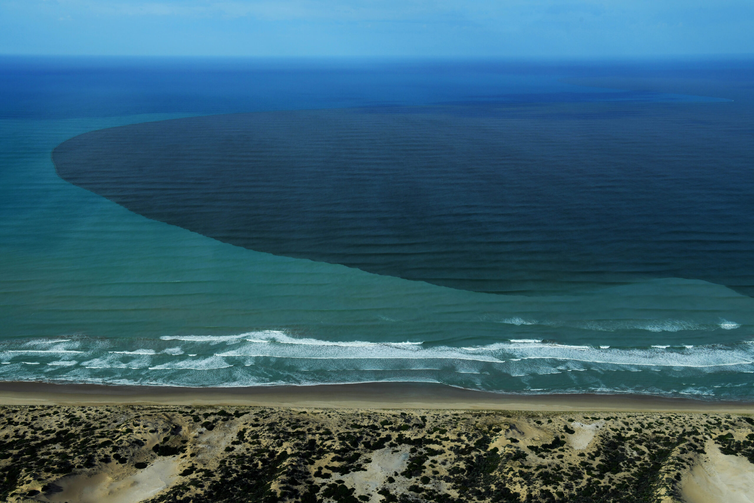
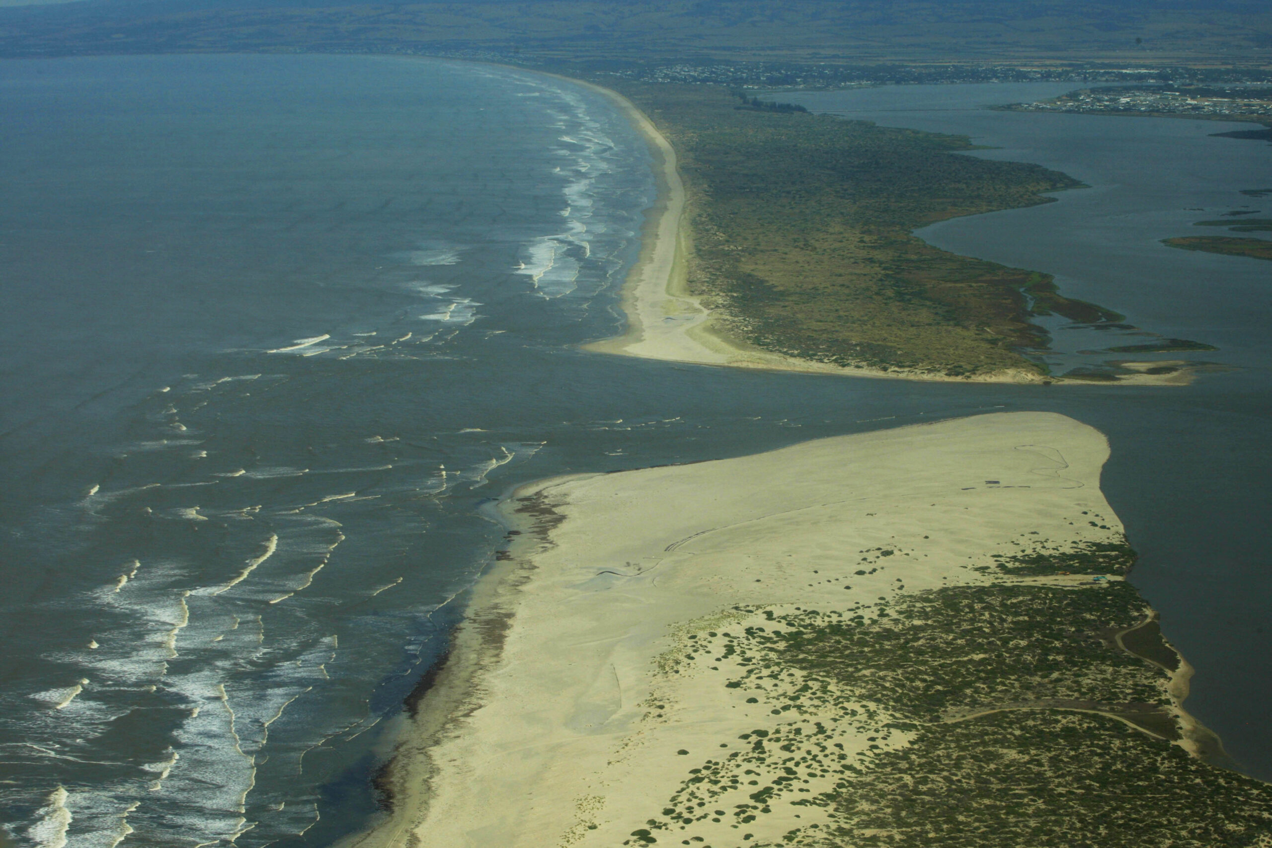
Most impressive from the air were the flood waters exiting the system, spewing waters that fell over a year ago out through the Murray’s mouth , the rancid brown plume mixing with the turquoise waters of the Great Australian Bight.
This assignment was made possible by Murray Bridge resident Emily Bessen who graciously donated her time and Cessna 182 to create this coverage.
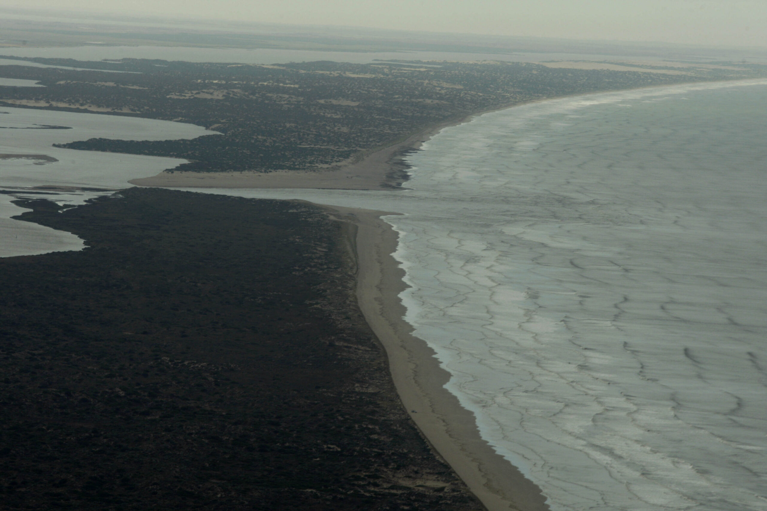
The almost identical scene back in 1956


May 4, 2023 at 7:06 pm
Brilliant !